The first Spanish travelers in Brazil

King Manuel I, who attached special importance to expeditions in the Atlantic Ocean, knew that, leaders of previous expeditions were experienced and skilful navigators and captains. So he couldn’t entrust inexperienced person with the “discovery” of Brazil. The king had two purposes in sending Cabral’s expedition to the Atlantic Ocean: to send marine under the leadership of the person, who knew the way to the Indian Ocean and to discover Brazil with the help of the seaman who knew certain part of coasts of South America.
What was the reason of such hastiness? Since 1500, Spanish travelers began to leave the Caribbean Sea and explore the territory of the continent located in the south.
N. S. Constantinova wrote: “After Portuguese received news that, Pinson approached Brazilian coasts on January 20 and Lepe did it on February 16, additional task also was given to the expedition”.
I want to elucidate route of expeditions travelled to Brazilian coasts. Parallels and meridians are the focus of attention. Tordesillas treaty had been concluded and borders had to be fixed.
Vicente Janez Pinson: Vicente Janez Pinson (1460-1523), who had won great confidence during the first travel of Christopher Columbus, sailed to coasts of the New World as soon as got patent of the king of Spain and approached the territory located at 80 south latitude – in the south of St. Augustine Cape of South America on January 20, 1500. Then he immediately changed the course towards the north-west and sailed towards today’s Guiana. Pinson discovered outfall of the Amazon River during that travel (as seamen, who were at 200 km away from the shore, understood that, water of the river is fresh, they called it “Fresh Water Sea”).
Diego Lepe: Another Spanish traveler by name Diego Lepe approached unknown land located at 100 south latitude on February 16, 1500 and noted that mentioned land extends towards the south-west. It means that, first of all Brazilian coasts were visited by Vicente Pinson and Diego Lepe, but not Pedro Cabral, so the discovery was made by them.
The king of Portugal had spies in ports of Spain and even in the palace of the kingdom, he received information by means of those spies when the Spain discovered new lands. They immediately gave information to Manuel I as soon as the travel of Pinson ended. So the king decided to hurry up.
The bull of the Pope Alexander VI had become trouble for Portuguese and Spaniards. Spaniards knew in which side of the demarcation line Big Anthill islands and Small Anthill islands of the Caribbean Sea were situated, but wandered through which part of unexplored lands located in the south of the Caribbean Sea that line passed before Cabral’s expedition. So it became possible to carry out exploration below the 28th parallel.
After Vasco da Gama discovered eastern seaway to India and returned to the motherland, Spanish monarchs annulled monopoly of Columbus in West Hind and issue patent for sending expedition to those territories.
Pedro Alonso Nino: One of persons, who got one of first patents, was navigator Pedro Alonso (Peralonso) Nino who had participated at three travels towards the New World coasts and he sailed to the Caribbean Sea with one vessel at the beginning of June, 1499. Nino who respected Tordesillas treaty, organized expedition towards the part of north coasts of South America located in the west. First of all, he wanted to define distance between newly discovered lands and demarcation line.
Alonso de Okheda: Alonso de Okheda, who was participant of the second travel of Columbus towards coasts of the New World, got permission for exploring those coasts before Nino and sailed directly towards the continent located in the south of the Caribbean Sea with three vessels. As two vessels had been given him by Florentine bankers, Amerigo Vespucci also participated in the expedition. Besides it, Chuan La Cosa, who had participated in the second expedition of Columbus and other well-known persons had been invited to the expedition. Okheda, who had prepared for the travel perfectly, analyzed the map of the Gulf of Pariah and Pearl Coast sent by Columbus to Spanish monarchs in 1498 before starting the travel. It proves that, he had sailed to coasts of the New World with the special mission. Following fact also proves it: some days after the expedition left the port of Cadis on May 18, 1499 he stopped one caravel on the way and made part of its staff to continue the expedition with him.
Amerigo Vespucci: Four vessels approached the coast in Oyapock Bay located at 50 or 60 south latitude and 510 west longitude at the end of June and were divided into two parts. Okheda continued his way towards the west-north-west with two vessels, but Vespucci sailed with the rest of vessels towards the south-west and saw outfalls of two large rivers flowing into the Atlantic Ocean – Amazon in the west and Para in the south on July 2 before Vicente Pinson. They filled barrels with fresh water at 45 km away from the coast. Vespucci sailed 100 km towards inwards together with 20 companions in boats, saw that there were dense wood and returned to vessels after two days. Though they continued their way towards the east-south-east on Jule 24, couldn’t overcome more than 250 km because of the current moving from opposite direction. Thus, Spaniards discovered Guiana current which’s speed was 3 km/hour and which was the branch of the South Passat.
Several scientists note that, Vespucci sailed 1200 km up to Turiasu Bay located at 10 30/ south latitude and 450 west longitude or to San Marcos Bay located at 20 south latitude and 440west longitude and returned towards the north-west. Vespucci met Okheda near Codera Cape after resting for a while in the island of Trinidad and they came to Spain in June of 1500.
Vicente Janez Pinson, who had participated at the first travel of Columbus towards coasts of the New World, left the port of Palos with four vessels bought with money of his relatives on December 1, 1499 and sailed directly towards Brazilian coasts. He changed the course towards the south-west in Green Cape Islands, passed the equator first of all his fellow-countrymen and unexpectedly approached San Roka Cape of Brazil (50 30/ south latitude) on January 26, 1500 after two-day ocean passage. Pinson went ashore together with notary and drove several wooden crosses into the ground. He declared that territory property of Spain kingdom in front of all staff.
After this discovery, Pinson continued his way towards the north-west and the coast disappeared from view after several days. Seamen, who saw that water of the ocean was fresh, began to sail towards the coast. Pinson reached the coast after overcoming 200 km and became the second person, who discovered outfall of Para River after Vespucci. Besides it, he discovered outfall of the largest river of the world after Vespucci and called it Mar Dulce (“Fresh Water Sea”) (waters of the ocean were fresh near the continent). Then Pinson sailed towards the north-west and reached coasts of today’s Guiana after Okheda. He explored 3000 km north coast line on his way and discovered 1200 km coast of the new continent. Experienced seaman understood that such coast line might only be specific for continent. But he thought that it was Asia. Thus, Pinson lost two vessels on the way and came to Palos with remained two vessels on September 29, 1500.
Bartolome Roldan: Diego Lepe left the port of Palos with two vessels in the middle of December 1499 two weeks after Pinson started his travel towards coasts of the New World. He sailed towards the south-west together with experienced navigator Bartolome Roldan and approached Brazilian coasts at 50 and 30/ south latitude on February 12. They continuedtheir way towards the south and reached the most outlying point of South America – Saint Augustine Cape (Kabu Branku Cape, 70 south latitude). After sailing 200 km towards the south, they saw that coast extended to the south-west. Just after it Spaniards returned back and repeated Pinson’s route. They entered Amazon, went up for about 400 km and Roldan noted all these facts in his new map.
Alonso Velez de Mendoza: They returned to Spain at the end of July of 1500, but after a while Roldan was invited to the next expedition to coasts of South America. The leader of that expedition was Alonso Velez de Mendoza – owner of the knight order and bankrupt noble-man. He left Seville with two vessels – “San Cristobal” and “Saint Ghost” (the second vessel was organized by brothers Luis and Anton Gerra) at the end of August and approached the coast at 30-35 km north of Kabu Branku Cape in November. Roldan showed himself as a real seaman and professional navigator during that expedition.
They continued their way towards the south without wasting any time and saw that the coast line extended to the south-west. Roldan reached outfall of the “Deer” River, may be San Francisco River on December 25 and rested there for several days. Vessels continued their way towards the south-west and reached the only large bay located in the north-east of the continent (Todos Santos, Bahia) and Jecitinonia River (160 south latitude) at the beginning of January of 1501. Alonso de Mendoza decided to return back just after it.
Though Spaniards couldn’t find valuable stones at that territory, they explored about 1000 km coast line and noted it on prepared map. Both vessels returned to Seville at the end of May and at the beginning of June in 1501.
As Spaniards explored territories of Portuguese, results of Alonso de Mendoza’s expedition had to be kept secret. They hoped to annul several paragraphs of Tordesillas treaty. Only after five centuries it became clear that, Bartolome Roldan approached Brazilian coasts before Cabral and could outline that territory.
The chronology proves that, expeditions sent by Spaniards to Brazilian coasts were organized systematically and the main task was to determine where that coast line extended to. So most of those expeditions were kept secret and their routes were coded.
Spaniards had other purposes in sending those expeditions to Brazilian coasts. They wanted to know exactly if there was land area on the demarcation line officially determined byPortuguese. After secret expeditions were sent to that territory, it became clear that, there were enough lands there and Spaniards understood that Portuguese had swindled them. But as the scale of deception wasn’t definite, Spaniards couldn’t protest against it. It needed to explore mentioned territory and so secret and permitted expeditions began to be sent there.
They were interested in one thing only: area of the land got by Portuguese in accordance with Tordesillas treaty and the latitude where it located. The border was definite owing to the meridian division and Spaniards wanted to know where that border extended to.
Pedro Alonso Nino explored those territories on the west of the demarcation line. Vicente Pinson went ashore and started exploration works at 80 south latitude, Diego Lepe at 100 30/ south latitude, Bartolome Roldan at 50 30/ south latitude, Alonso de Mendoza at 70 south latitude. Vicente Pinson, Diego Lepe, Pedro Alonso Nino and Alonso Okheda explored Brazilian coasts on the north-west after they went ashore, but Alonso de Mendoza did it on the south-west.
Amerigo Vespucci, who had participated in the expedition of Vicente Pinson, approached Brazilian coasts at 50-60 south latitude and sailed towards the south. He had to determine where southern coasts of Brazil extended to. But he couldn’t fulfill his mission too. As if, all travelers had to prevent Spaniards’ indifference in those territories in accordance with the special task.
Spanish monarchs wanted to know which part of lands located on the other side of the Atlantic Ocean became Portuguese’s property after Tordesillas treaty. After the distance between parallels was calculated, it became clear that, they owned very large territory. It means that, Portuguese sea travelers owned very large territory without any trouble. May be,Portuguese, who pretended as simpleton when Tordesillas treaty was concluded, swindled Spaniards? They could increase the demarcation line for 270 liq during the second division and take the territory as large as today’s Brazil from Spaniards.
Brazil belonged to Portuguese in accordance with Tordesillas treaty, but it had to be registered officially. After the discovery was registered, expeditions would be sent for exploration of that territory. Several candidates were presented to the king for realization of this work, but he chose Gonzalo Coelho. It is very interesting that, though that expedition was very important, name of its leader was kept secret for several centuries. The great adventurer Amerigo Vespucci showed this travel as his own achievement. As if, he was the leader of that expedition in 1501-1502. But justice is restored sooner or later.
Gonzalo Coelho, who had left coasts of Portugal in 1501, was known as the assistant of Vespucci for a long time. It had been mentioned in several sources that, Vespucci had explored northern coasts of South America within the expedition of Alonso Okheda. He visited coasts of this continent during the expedition of Coelho for the first time. Vespucci was non-official navigator within the expedition of Coelho sailing to Brazilian Coasts and he had to write everything happened during the exploration. His notes are still remaining together with several maps of “Santa Cruz” or “Land of parrots” – coast line of Brazil together with rivers and bays made in XVI century.
Thus, captain-general Coelho left Lisbon with three vessels on May 10, 1501 and met with the expedition of Cabral returning from Green Cape Islands on June 1. His mission also was considered partly secret. But in spite of it, he had got some information about Cabral’s travel to Brazilian coasts and understood that, travelling to the west of the Atlantic Ocean was easier than travelling to India and south of Africa.
They met with Fernando de Noronha Island surrounded by rocky places after five-week ocean passage as soon as found fresh water in Bijagos archipelago during 11 days and reached the coast of the continent on August 17. Portuguesestayed in the first cape for a week and then continued their way. Two seamen went ashore in order to establish commercial relations with indigenous population, but didn’t return back. Though Vespucci offered to punish Hindus, Coelho sailed towards the south without any conflict. As exploration of the coast line was especially significant, every point was noted exactly. Every point was called by names of holy persons. Those names show which point they visited first of all in the north.
Some scientists write that, a number of seamen used to make efforts in order to discover Brazil. A man by name John Jay organized an expedition on his own account in order to discover the Brazil Island in 1480. He thought that, it was situated in the west of Ireland. After six-week travel, the expedition returned back without achieving any results.
Seamen reached Angra dos Reis bay on January 6, San Vicente Island (240 south latitude) after 16 days and outfall of Cananea River at the end of January (250 south latitude and 480west latitude). There Coelho completed his works and decided to return to the motherland. One of vessels of Ferdinand de Noronha left the marine and came to Lisbon on June 24, 1502.
We met with the fantasy of Vespucci when chronology of this expedition is analyzed. According to his information, remained two vessels left Brazilian coasts on February 13, continued the expedition towards the south, overcame 3000 km and met with new land at 520 south latitude on April 3. I.P. Magidovich and V.I. Magidovich suppose that this land was Trindade Island located at 200 south latitude and 300 west longitude. There seamen asked the captain-general to return back and they reached coasts of Sierra-Leone on May 10. There Coelho burned one unfit vessel, continued his way and dropped anchor in Lisbon on September 6, 1502.
Though the expedition couldn’t find any gold and silver, it could achieve great geographical successes. It explored 3000 km coast line between San Roka Cape and Cananea River from 50 30/ south latitude to 250 south latitude, 1000 km from 50 30/ south latitude to 160 south latitude and included them in the new map.
Achievements of that expedition kept as secret for 450 years and Vespucci had significant role in it. He hadn’t mentioned name of Coelho when wrote about the expedition and misappropriated all achievements of the mission. Only at the end of 60th years of XX century, an old map of 1504-1505 was found in the library working in Fano, Italy. Brazil was called“Land of Gonzalo Coelho” in that map. After it, it became clear that, Coelho had played significant role in exploration of Brazil.
It is necessary to analyze geographical points where Coelho approached in order to determine real purposes of Portuguese, to learn if Cabral reached Brazil by accident and if any traveler visited that continent before Cabral.
The expedition approached San Roka Cape at 50 30/ south latitude in the north on August 17. That cape had been discovered by Pinson and Lepe a year before. Portuguese had to work there in order to disconsider exploration works carried out by Spaniards in that territory as the territory might be lost later. Portuguese had to prove that vessels of Pinson and Lepe approached Brazilian coasts in the east of the demarcation line and results of their activities had to be disconsidered. Portuguese had to end Spaniards’ activity in accordance with juridical documents.
Several sources prove that, Coelho didn’t know at which latitude Cabral approached Brazilian coasts. But it doesn’t seem convincing as Cabral sent Gaspar de Lemos to Lisbon on May 1 in order to inform the king about the “discovery” after Brazilian coasts were seen. So we may note that, Gaspar de Lemos met Coelho in Lisbon and got information about Brazil. Thus, Coelho knew that, Cabral had approached the coast at 160 30/ south latitude (today’s Porto Seguro).
Coelho, who could disconsider Spaniards’ achievements sailed towards the south and reached Saint Augustine (Kabu Branku) Cape on August 28. He met with well-mannered Hindus in the south and three Hindu women agreed to go to Portugal together with comers. Seamen stayed there for a month and then passed outfalls of small rivers flowing from Borborema mountains – San Miguel (September 29), San Geronimo (September 30) and San Francisco located at 100 30/ south latitude (October 4). The expedition approached Todos Santos bay located at 130 south latitude on November 1. It was the coast of the largest bay of the territory and later it began to be called “Bahia” (Bay). In Porto Seguro the expedition took two sea boys left by Cabral a year and a half before. It proves that Hindus were peace-loving people. Portuguese, who continued their way, left the outfall of Santa Lucia (Dosi River) behind on December 13, passed San Tome Cape (220 south latitude) on December 21, again sailed towards the west and reached amazing Guanabara Bay on January 1. They thought that it was the outfall of the river (230 south latitude) and called it Rio de Janeiro – “January River”.
Though members of the expedition sailed to Brazilian coasts in order to explore those places in accordance with the official statement, they had more important task in reality. According to that task, Coelho had to determine at what distance of the eastern or western part of the demarcation line fixed in accordance with Tordesillas treaty the territory “discovered” by Cabral was situated. As if, previous expedition hadn’t been able to determine coordinates of the coast. Portuguese did it in order to disguise the lie described in Tordesillas.
Thus, three caravels of Coelho went down for 500 km from the point they had approached in the coast and reached the outfall of large river on the first day of 1502 (territory of today’s Rio de Janeiro).
Vespucci sailed to those coasts during the second expedition (1503-1504) together with Coelho, described most events happened during that travel in his writings and published them in Europe for several times. I want to note that, the mentioned travel could end with tragedy.
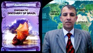
President grant holder on literature, laureate of the “Golden pen” award Ramiz Daniz